|
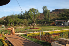
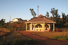
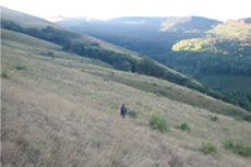
Kotagiri Hill Station - Tamil NaduKotagiri Hill StationKotagiri hills is located about 30 kms east of ooty 23 kms from Coonoor and 33 kms from Mettupalayam is one of the oldest and the largest of the hill stations in Tamil Nadu. It is situated at a height of 6511 ft above the sea level. It is protected by the Doddabetta range from the violent southwest monsoon and is not affected by mists which are so common at Coonoor. The lower elevation of the place makes it warmer than Udhagamandalam. These advantages in the climate make the station a fine health resort.
Catherine Falls : Catherine Falls is about 8 kilometres from Kotagiri, named after Catherine, the wife of Mr.M.D. Cockburn. This couple was among some of the first Europeans to settle in Kotagiri and they lie buried side by side in the cemetery there. The Falls are at a distance of 7 km. from Kotagiri and consists of an upper and a lower fall. The upper fall, which is the second highest in the Nilgiris, takes a leap of about 250 feet. From above the falls, one can see the magnificent view of Dolphin's Nose and the surrounding places.
It commands a panoramic view of the plains and the eastern slope of the Nilgiris. The panoramic view of the Thengumarahada , the Bhavanisagar dam, the tea estates and the river Moyar is breathtaking. Tamilnadu and karnataka State border and the actual point where the eastern and western ghats meet can be distinctly seen. This place is to be visited in bright sun light. A telescope has been installed to see the places, around and apart. Longwood Shola: Longwood Shola is the only major pocket of natural shola forest left in the immediate vicinity of Kotagiri in the Nilgiris. This shola is an integral part of the very fragile Nilgiri eco-system with an area of 116 hectares. The preservation of this shola forest is very vital. It plays a vital role in Kotagiri's microclimate, attracting and regulating rainfall. There is a very picturesque trekking path, which goes through this serene shola. On the north west of Rangaswamy Peak is found the Rangaswamy Pillar, which is an extraordinary isolated rocky pillar rising in solitary grandeur to a height of some 400 feet and has sheer sides, which are quite unclimbable. How to Reach Nandi Hills:By Air : The nearest airport is Madurai 135 kms, Coimbatore 170Kms and Trichy 195 Kms.By Road : Kodaikanal is connected by Road with all important towns. Regular bus services are available from Kodaikanal to Madurai, Palani, Kodai Road, Theni, Dindigul, Thiruchirappalli, Kumuli, Bangalore and Coimbatore. By Rail : Many Passenger trains passes through Kodaikanal road. Kodairoad Station is nearly 80 kms.
Photo Gallery of Kotagiri Hill Station


|
||||||||||||||||||||||||||||||||||||||||||||||||||||||||||||||||||||||||||||
|
|
|
| Home : : Feedback : : About us : : Contact
us : : Advertise with us : : Sitemap
|
| © Copyright 2011 In4india.com. All rights Reserved. Designed & Developed by CKR Infotech |


 Featured eShowrooms of (New Cars)
  Featured eShowrooms of (Moblies)
  Featured eShowrooms of (New Cars)